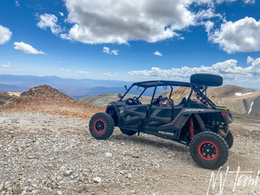
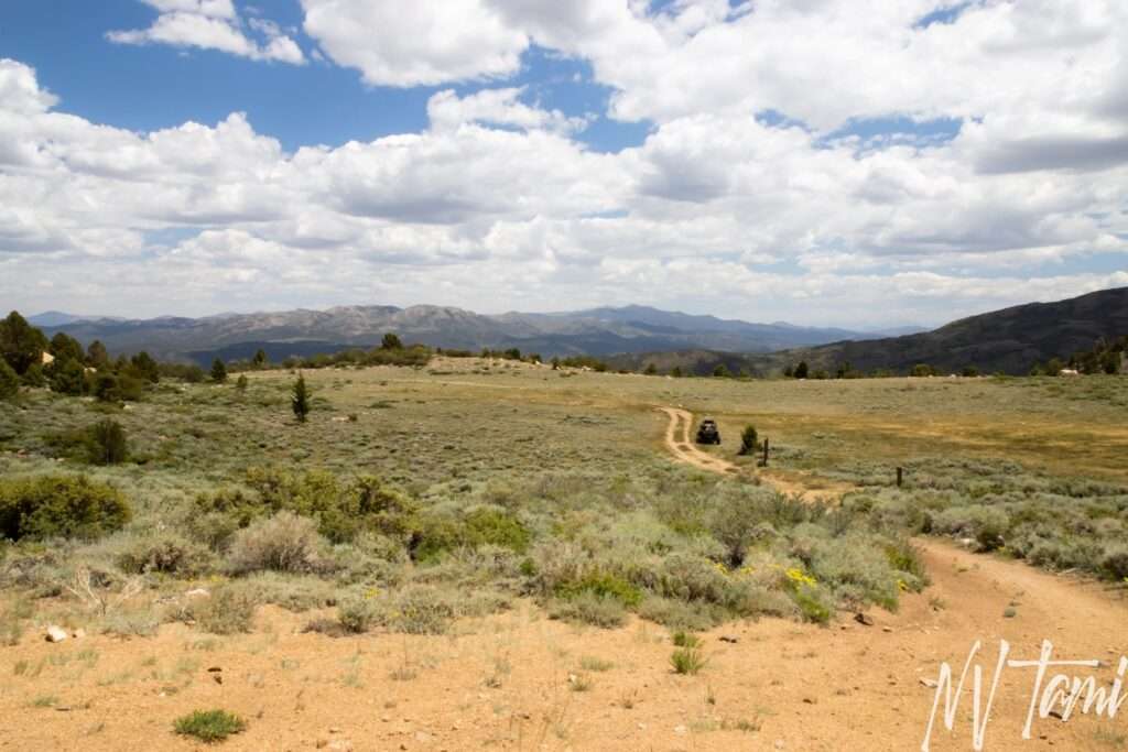
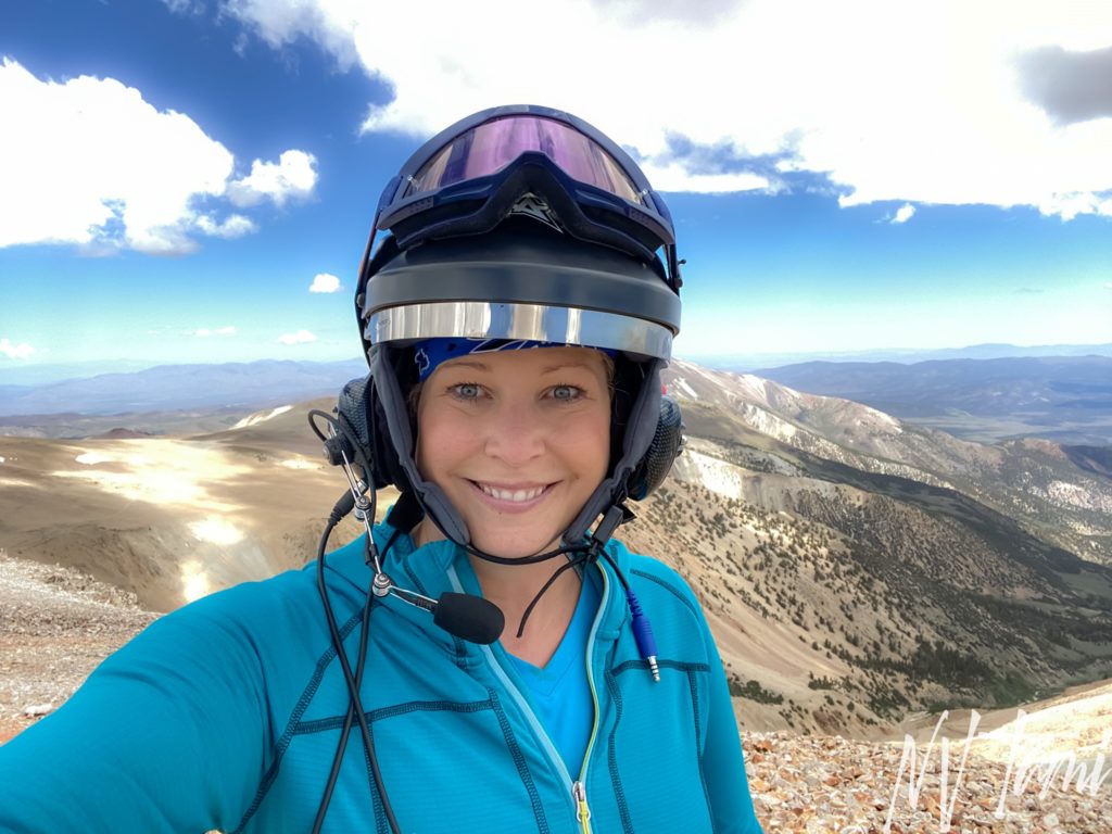
The Sweetwater Mountains straddle the border of Nevada and California. Highway 388 runs on the east side of the range through Sweetwater Flats and is one of my favorite Sunday drives. The Sweetwater Mountains are beautiful: meadows, the East Walker River, and multiple peaks over 11,000′. Usually, I see the area from the highway as most of the range is remote and accessible only by 4×4, ATV, horse, or foot. My friend Gregg camped along the East Walker river and offered me a ride in his RZR up the range to some locations difficult to access, even in a Jeep.
The day started beautifully and with a clear weather forecast. By the time we were halfway up the mountains, storm clouds were starting to build. We decided our first stop would be the peak of Mt. Patterson and what people call “Stone Cabin.” It took some searching once I returned home, but I found Stone Cabin is part of the Montague Mine.
Mt. Patterson Mining District
Miners were drawn to the Sweetwater Range in the 1860s to harvest trees for use in the mines and towns of Aurora and Pine Grove. They explored the area, but prospecting was limited until the 1880s, when the Patterson Mining District was formed. Between 1880 and 1884, $500,000, $13M in 2021 value, was produced in the district. By 1888 only one mine remained active. Prospecting and limited mining resumed between 1900 and the 1930s.
Half a dozen mining towns sprung up in the Sweetwater Range, including Belfort, Mone Cristo, Star City, and Clinton, the largest and longest-lasting town. Sweetwater was the major supply center in the area; in the 1860s, it was a station stop on the Carson to Aurora stage. The small town of fifty soules had a store that served local miners, and a post office opened on January 26, 1870.
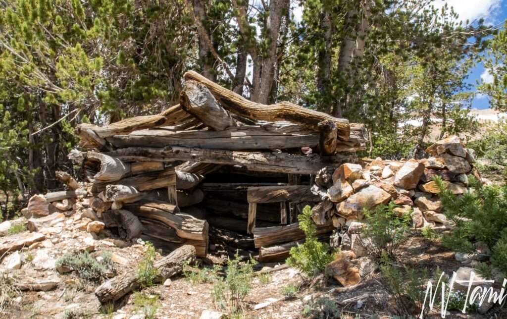
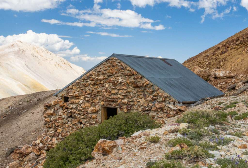
Montague Mine
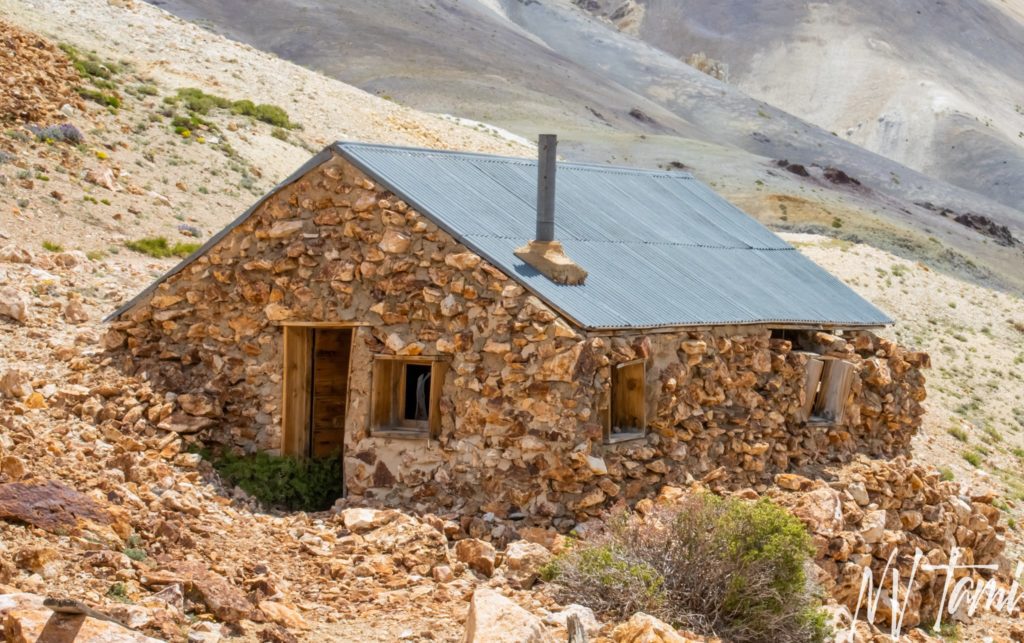
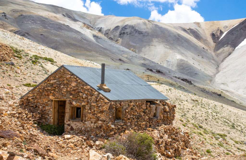
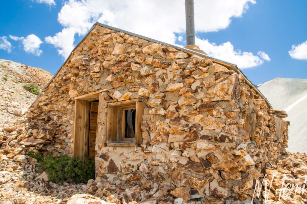
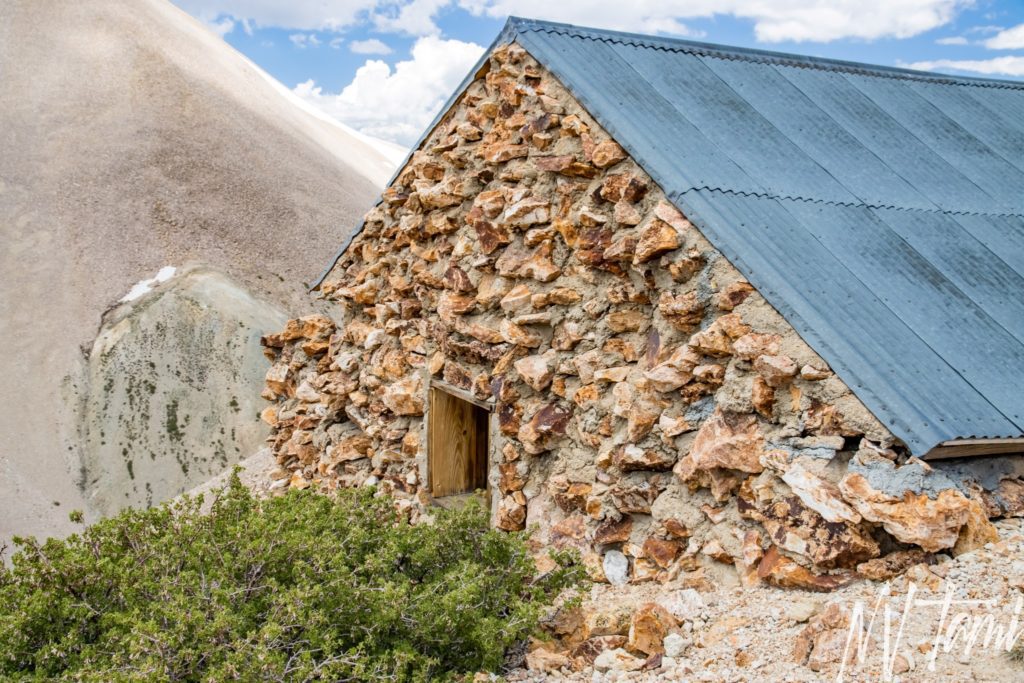
Due to an elevation of 10,961′, the Montague Mine would have been worked between July through October when winter storms moved in. The Montague mine was an underground mine that primarily produced gold and some silver. It is located in the Comstock Gold-Silver Belt, which runs on the crest of the Sweetwater Range.
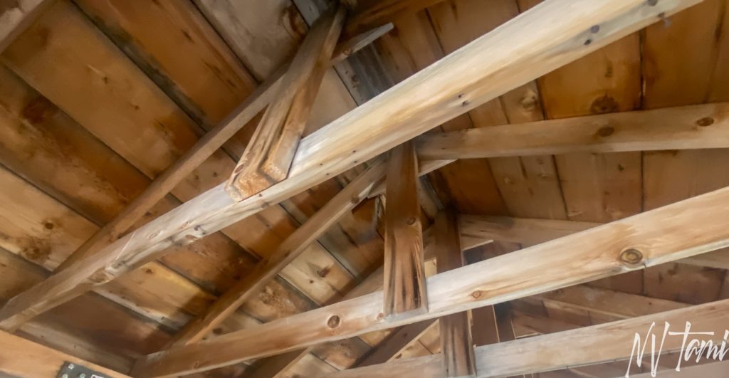
According to a man who helped stabilize the cabin, Guy Montague owned the mine. He had previously worked in the Balatoc gold mine in the Philippines and built the cabin between 1937 and 1939. Order L-208 closed non-war-related mining during WWII. Due to the low grade of silver, it was not reopened following the war.
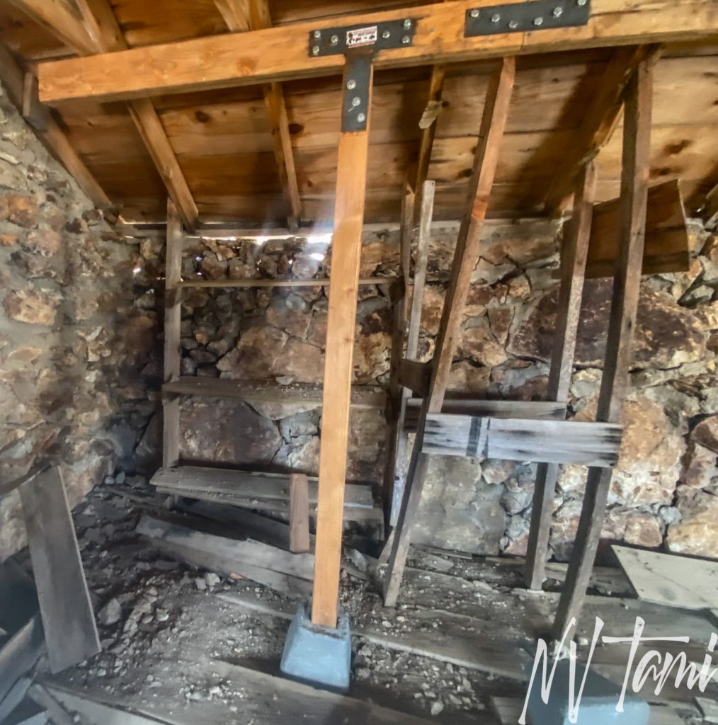
Stone Cabin is in amazing condition, especially given the harsh winters. It is constructed of local stone and is larger than many miners’ cabins. It appears someone has shored up the roof with concrete footings and headers. One corner of the cabin has begun to slide down the steep slope.
Ghost Towning, Part I
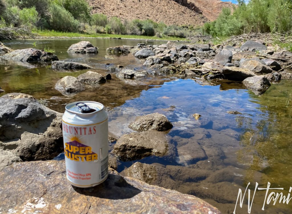
On my first trip, Gregg and I spent the day around Mt. Patterson and the Sweetwater Range. We visited the top of Mt. Patterson, Belfort, Boulder Flats, Star City, and Sweetwater. We ended our day by cooling off at the East Walker River.
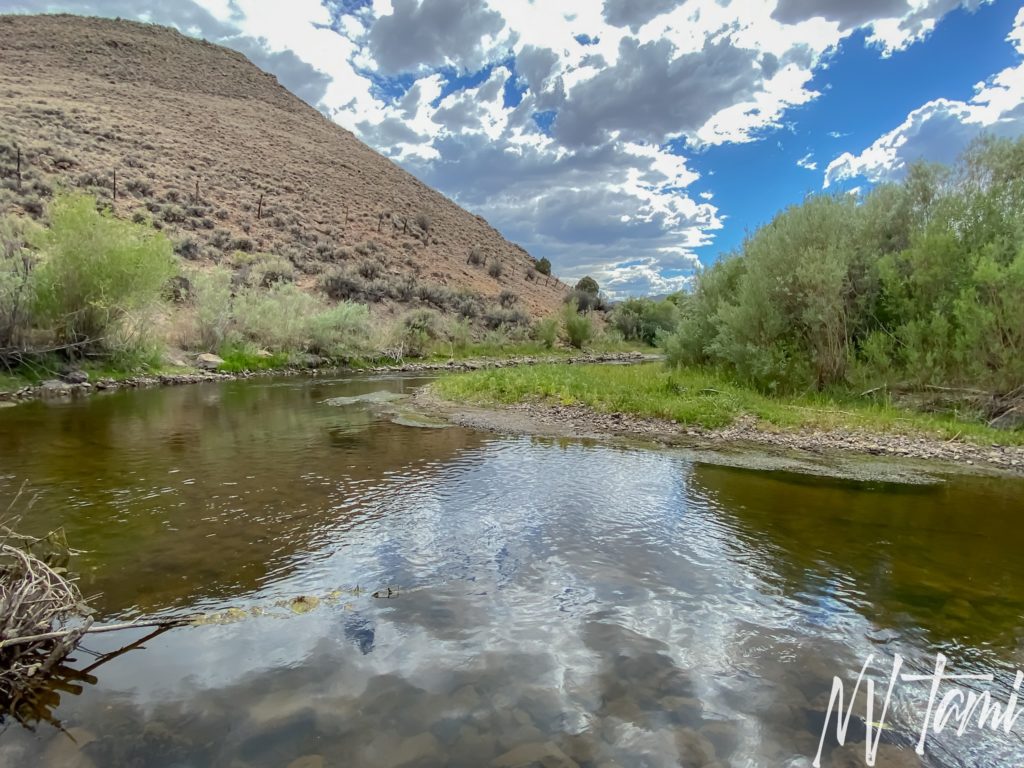
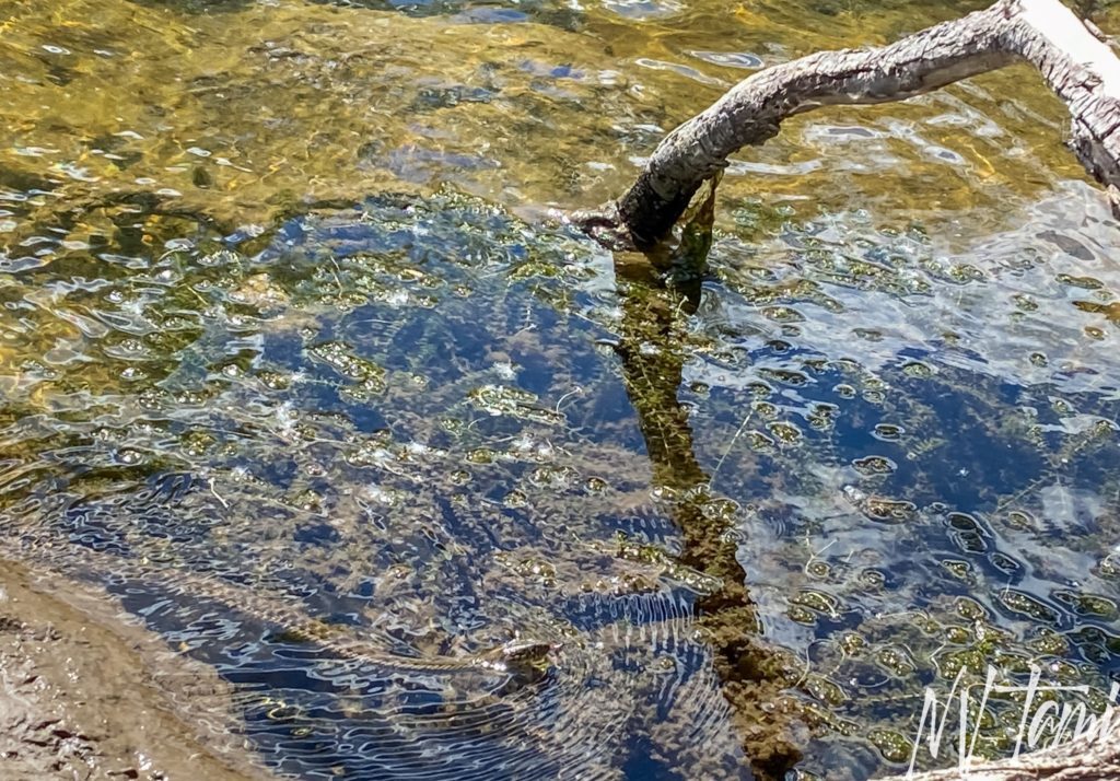
Every day is a new opportunity to learn. This day while soaking my feet and enjoying a beer, I learned Nevada has water snakes. Sorry about the quality of the photo; those suckers are fast, and no way was I getting closer!
Ghost Towning, Part II
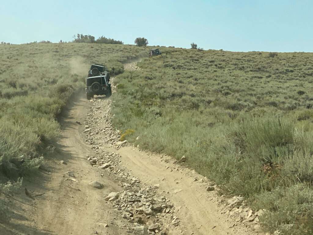
In August, an offroad group planned a trip up Mt. Patterson. Six jeeps headed up on a smoky and cool morning, this time approaching from Desert Creek.
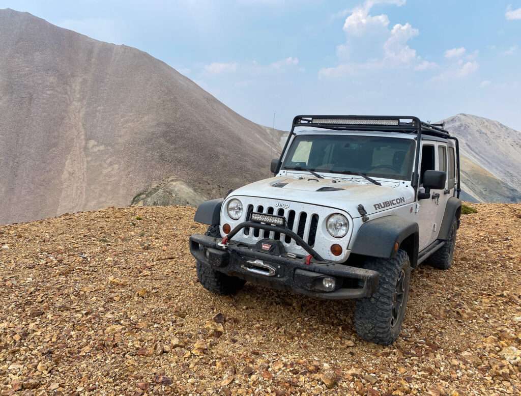
We enjoyed lunch at Montague Mine. With so many vehicles parked in a tight area, I couldn’t get a picture of Honey Badger with the stone cabin.
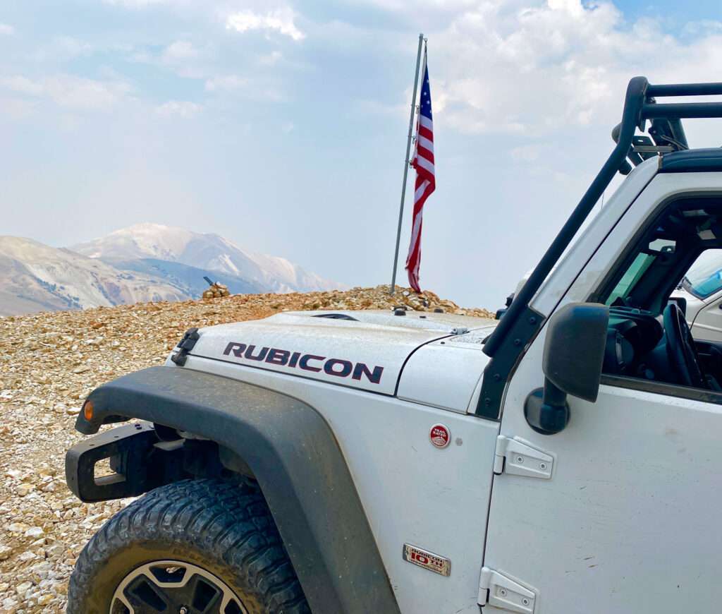

Our next stop was at the top of Mt. Patterson. I was hoping to get a picture of me with the flag blowing, but it was calm when we arrived.
A friend sent a new flag for me to replace the damaged one. The new flag is too big for the pole, and the plan was to raise a temporary flag so repairs could be made. I decided climbing on top of a Jeep, holding onto a metal pole over a cliff at almost 12,000′ with an incoming thunderstorm, wasn’t a great idea. It was replaced a few weeks later and my friend sent me a picture.

Visited 6-25-2021, 8-2021
References
- Dangerous Roads: A mining road to Mt. Patterson California
- The Diggins: Montague Gold Mine
- Fourwheeler: Ghostly travels in the Sweetwater Range
- Gamett, James and Stan Paher. Nevada Post Offices: An Illustrated History. Nevada Publications, 1863. Page 124.
- Huegel, Tony. Sierra Nevada Byways: 51 of the Sierra Nevada’s Best Backcountry Drives. Wilderness Press, 2008. Pages 114-115.
- Mitchell, Roger. Inyo-Mono SUV Trails. Track and Trail Publications, 2003. Pages 24-28.
- Paher, Stanley. Nevada Ghost Towns and Mining Camps. Nevada Publications, 1970. Page 87.
- Paher, Stanley. Nevada Ghost Towns and Desert Atlas. Nevada Publications, 2009. Page 204-205.
- Western Mining History: Montague Mine
- Western Mining History: Montague Mine Star
- Western Mining History: Patterson District
- Wikipedia: Sweetwater Mountains
Jon Patterson says
The article says $500,000 of its mine production in 1880’s would be worth $1.3 MM in todays dollars ; actually it would be worth about $13 Million today.
JWP – Economist
Tami says
How weird, I responded yesterday but it didn’t go through. Our internet system was taken out by lightening and we are limping by on limited a hot spot.
Thank you for catching the error, 1.3M certainly didn’t look correct. I thought maybe it was my typo and checked the conversion site I used and it gave me the same results. Needless to say I started looking for anther site, I used CPI inflation calculator yesterday and got correct results. If you know a great site please let me know. The article has been updates and I am currently working on Belfort, Star City and Boulder Flat.
Rick says
Which area of the East Walker was the photo from ? Near the Elbow (Bighorn Campground now)
Tami says
It was east of Bighorn and Two Trees. It is off the road to Fletcher and Nine Mile.
BP says
Can you overnight at the mine? Not in it but at the site?
Tami says
I would think so, as it is public land, but check with the local forest service office.
Roger says
The actual mine was closed off by explosives 8 or 10 years ago. The unique stone cabin has been given TLC by the locals down through the years but when I last visited in the fall of 2022 someone had knocked down all the 4×4’s that we had put up to support the roof and we could not get back up there to do repairs before early snows made it impossible. I sure do hope it survives the 2022/2023 winter but I have my doubts. I just cant wrap my head around why anyone would do such intentional damage to a rare and valuable historical object!!!
Tami says
Thank you for the information, I will have to update my article.
I could tell people had been working to preserve the cabin. It is sad someone knocked down the supports, I don’t understand why people do stuff like that. I was last there in the fall of 2021.
I am worried about the cabin too, with no support and the heavy winter, it could easily collapse down the mountain.
Todd says
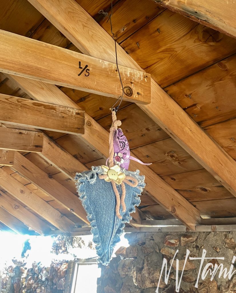
A friend of mine said he seen a jar syrup in middle of table in the 60s so in the 80 I seen the syrup on the shelves in corner behind door so I put it back on table did that until 3 years ago then I could fine syrup. I run cattle on mountain from boulder flat an long meadow south. I go check cabin every year.
Tami says
I bet you have seen lost of cool things. I love Mt. Montague, each winter I hope it survives.
terry says
from roger’s comment- the sierra club and like groups are heavily pushing for more wilderness. if there are man made structures on the property then anti wilderness people argue that it doesn’t fit the wilderness definition. old wood building burn down under mysterious conditions and stone structures can be made to crumble.
Tami says
Sadly, at some point, the cabin will slide down the mountain. Access is a big issue, too; there are huge places they want to be close to everything but hiking. Except for extreme athletes, no one would be able to reach it.
I know of one wilderness area where they would destroy a historic structure, and advocates fought and saved the building.